

Facing the Problem Head-On
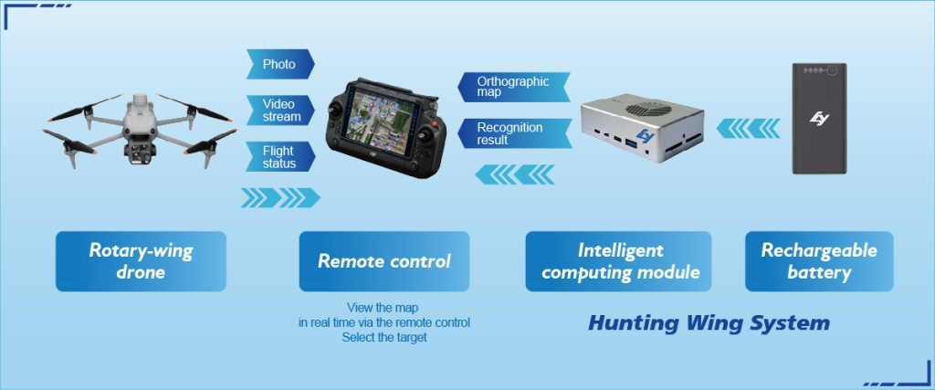
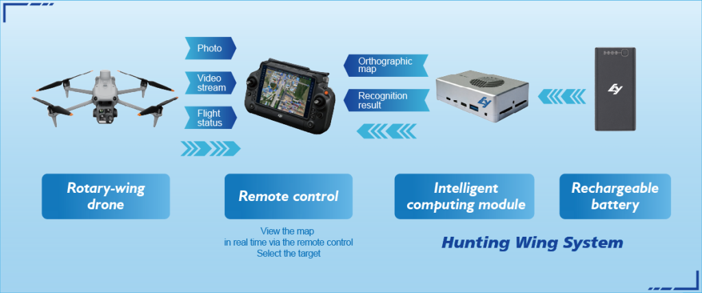
Wildfires outpace plans. Sensors spit numbers. Command teams drown in disjointed feeds while firelines need actionable directions. We need streamlined situational awareness that pushes decisions to the front lines — now. High-altitude UAV data, thermal imaging, and live telemetry must translate into one coherent picture. Early wins come from targeted drone reconnaissance integrated with field radios and mapping tools so crews see heat sources and access routes in real time.
Why Current Systems Fall Short
Most platforms treat sensors as trophies instead of instruments. Data formats clash. Timelines lag. The result: delayed evacuations, wasted aircraft sorties, and missed containment windows. Look to the 2018 Camp Fire—response teams had aerial imagery but lacked quick, fused insights to protect critical infrastructure and evacuate effectively. That gap is avoidable with pragmatic engineering and workflow design.
What an Integrated Intelligence Platform Actually Does
Think of an intelligence platform like a disciplined trainer: it collects, cleans, fuses, and delivers only what matters. Geospatial layers unify LiDAR-derived terrain, thermal hotspots, and crew positions. RTK-corrected GPS improves map precision. The platform reduces noise, highlights anomalies, and pushes concise directives to commanders and crews. This is operational clarity—faster decisions, fewer wasted resources.
Portable Tools for Field Teams
Field teams need small, rugged systems that talk to command. Portable units for radio relay, portable drone detection, and quick-deploy ground sensors close the loop between air assets and boots on the ground. Integrating portable drone detection with base maps and incident command systems prevents duplication of effort and protects aircraft safety—crucial when manned and unmanned assets share airspace.
Common Mistakes and Real Fixes
Leaders often overbuild dashboards — too many layers, too few actions. They buy sensors without onboarding crews or automating alerts. Instead, prioritize three moves: enforce strict data schemas, automate rule-based triggers for thresholds, and train teams on short, repeatable procedures. Small drills that force handoffs between UAV pilots, analysts, and suppression crews cut response time dramatically — and morale improves when feedback is fast.
Operational Teardown Notes
When teams audit deployments, they should run a compact operational teardown: validate sensor latency, verify geospatial accuracy, and test comms redundancy. Include {main_keyword} and {variation_keyword} in those checks so the production teardown covers searchability and tagging in data stores. Keep logs simple and retrievable — that beats elaborate, unmaintainable schemas.

How to Evaluate Platforms — Three Golden Rules
Pick tools by measurable fit, not flashy specs. Use these three critical metrics: 1) Latency under operational load — can the system push a hotspot to mobile units within the mission window? 2) Interoperability — does it accept feeds from common UAV telemetry and export to standard incident command formats? 3) Field robustness — are devices and comms proven in rough terrain and heat? These metrics deliver repeatable selection outcomes and reduce hidden costs.
Closing Takeaway
Integrated wildfire intelligence turns scattered inputs into sharp action. Teams get clear objectives, aircraft operate safely, and crews move with confidence. The value lands when field-tested tech and disciplined workflows meet — and that’s where Icecypress Technology fits as a practical partner for end-to-end systems. —
Icecypress Technology provides tools and integration patterns that make these outcomes reliable and repeatable. Final thought — train hard, instrument smart, act fast.