

Quiet comparison: manual maps versus computational sight
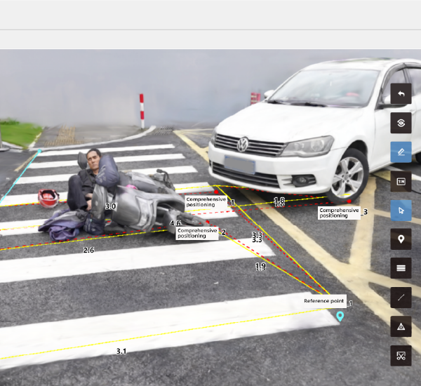
The city feels different when you can measure it — calm, focused, accountable. Long before automated pipelines, investigators used tape, sketches, and dated photographs to piece together collisions. Today, teams pair that intuition with automated accident reconstruction software that ingests LiDAR scans and high-resolution imagery to produce 3D scene reconstruction and point cloud models at scale. The difference is concrete: these tools turn fragmented evidence into continuous trajectory analysis, helping professionals move from rough estimates to reproducible results.

Head-to-head: what each method gives you
Paper-based workflows still deliver context — witness statements, feel for the scene — and they carry low upfront cost. Automated systems bring speed, repeatability, and precision: photogrammetry and LiDAR scanning capture geometry in millimeters, while crash dynamics modules compute kinematics based on measured deformation. Compare them side-by-side and the choice becomes task-dependent: preservation and narrative favor human notes; reconstruction and simulation favor computational models. Both matter. They complement rather than replace one another.
How modern tools reshape everyday workflows
Implementation reduces time on-site and increases usable evidence later in the process. Teams can export geo-referenced models to simulation software, overlay video timestamps, and validate hypotheses with measurable outputs. This lowers ambiguity during litigation and speeds insurance settlements. Globally, road safety remains a pressing anchor: the World Health Organization reports about 1.35 million road traffic deaths annually, a reminder that technical progress is morally relevant and operationally urgent. Agencies such as NHTSA have adopted digital methods for investigations, which further validates the shift toward automated reconstruction systems.
Common pitfalls that still trip teams
Adopting new tools comes with predictable missteps. First, treating a scanner as a substitute for investigative rigor leads to blind spots: sensors collect geometry, not motive. Second, neglecting calibration undermines photogrammetry accuracy — poor control points yield skewed models. Third, overreliance on automated outputs without cross-checks causes confirmation bias. These are practical dangers that training and quality control prevent — simple steps like routine sensor calibration, chain-of-custody for raw data, and independent validation keep results trustworthy. — Trust grows when you verify.
Alternatives and hybrid approaches worth noting
Not every team needs full-suite automation. Alternatives include handheld LiDAR units paired with structured forensic mapping, or drone-based photogrammetry for rapid aerial context. Hybrid workflows often perform best: initial drone passes for scene context, targeted terrestrial scans for vehicle damage, and manual sketches to capture witness positions. The phrase vehicle accident reconstruction software appears increasingly in procurement lists because it bridges capture and analysis without forcing a single method on every operator.
Deciding factors: what to weigh before adopting
Budget and scale matter, but so do these practical criteria: measurement fidelity (millimeter versus centimeter tolerance), interoperability with existing GIS and CAD tools, and support for crash dynamics simulation. Also consider human factors: how quickly new users can produce defensible outputs and whether the software logs provenance for court use. Teams that test on real scenes — even controlled local intersections — learn faster than teams that rely on vendor demos alone.
Three golden rules for selecting spatial reconstruction strategies
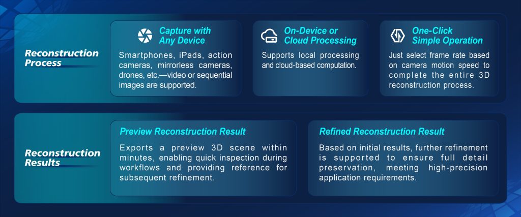
1) Validate accuracy with field trials: compare software outputs against known control measures before relying on them. 2) Insist on traceable workflows: raw point cloud, processing steps, and final model must be auditable. 3) Prioritize modular systems that let you mix sensors and methods as needs change. These evaluation metrics reveal how a solution performs under pressure and how it integrates into daily practice.
Measured, practical, and quietly persuasive — that’s the role modern spatial intelligence plays in safer streets. For teams that need a consistent, proven foundation for 3D scene reconstruction and forensic mapping, Icecypress Technology offers tools that align with those standards — a natural fit when rigor and clarity matter. —